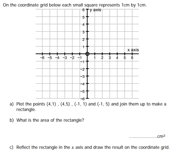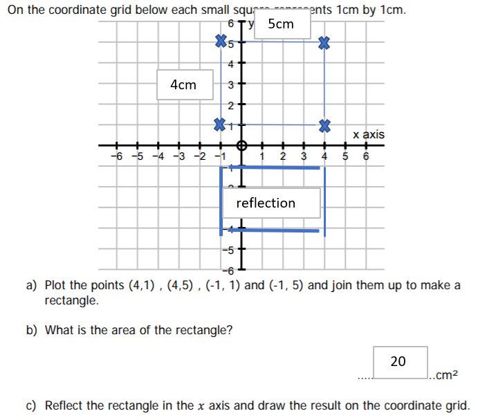
Reflection is per the grid markings
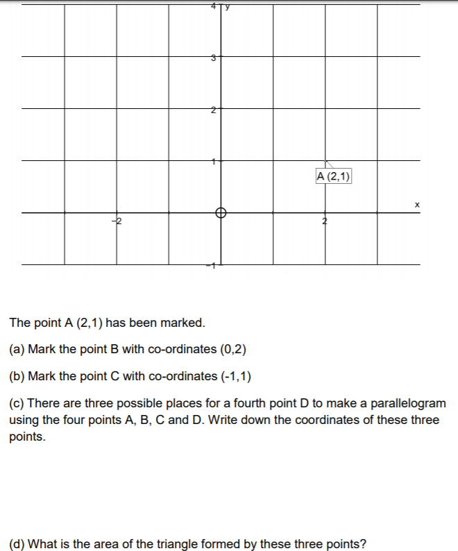
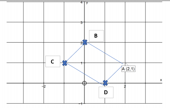
D Coordinates are (1,0)
Area = 3 square units
a) 7:10
140:200 = 14:20 = 7:10
b) 30cm
If model is 9m, = 900cm. Therefore 900/30 = 30cm
c) 1:50
120cm:6000cm = 1:50
South
West starts from 270 degrees. (North being 0 degrees, East 90 Degrees, South 180 Degrees, West 270 Degrees)
So 90 degrees c/wise takes you back to 0 degrees and North. This leaves 180 degrees which takes you to South
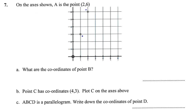
See below
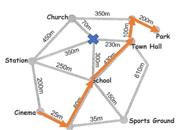
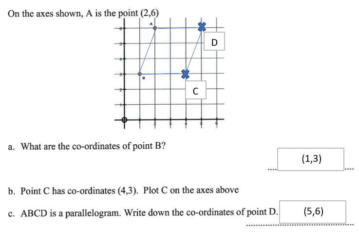
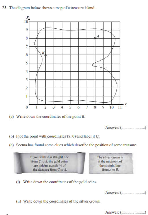
a) (2,6)
Read horizontal axis always first when reading coordinates. Then Vertical axis
b) See below
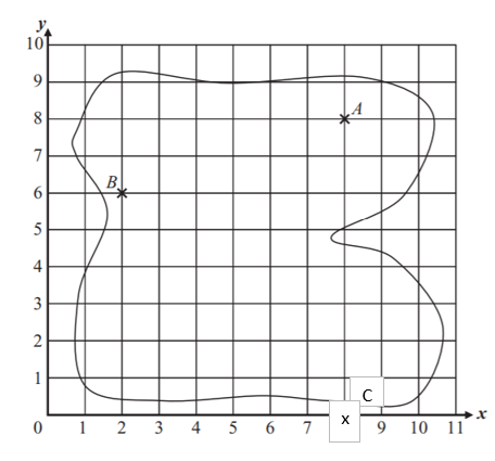
c) i) (8,2)
A quarter of the distance from C to A would be from (8,0) to (8,8). Therefore, the difference in spaces is 8 on the vertical axis from C to A. 1/4 of this is 2 so the revised co-ordinates would be (8,2).
c)ii) (5,7)
A is (8,8) and B is (2,6). The difference between the coordinates is (-6,-2). Therefore, you move half of this from the point A which means you move by (-3,-1) from point A. This would give revised co-ordinates of (5,7) for the Silver. You apply addition and subtraction techniques in Coordinates
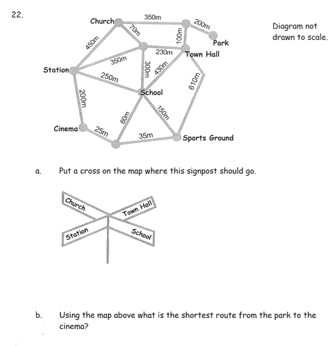
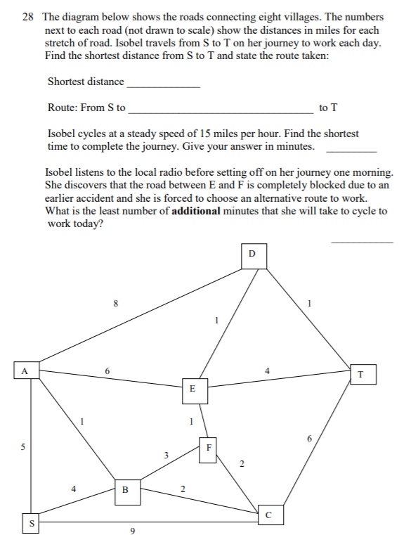
i) 10 miles
ii) S to B to F to E to D to T
The thing to note here is that the map is not drawn to scale so extra attention has to be paid to the miles between different points
iii) 40 minutes
Time = Distance/ Speed. So substituting into the formula, Time = 10/15 which = 2/3 of 1 Hour (10/15 x 60). So thats 40 minutes
iv) 8 minutes
The revised route is S-B-C-T. So an extra 2 miles
This means 12/15 of 1 hour so 12/15 x 60 = 48 minutes
Difference being 8 minutes

